
Large coastal area of Mani declared archaeological site
Tharros reports on a landmark decision for the protection of caves and rock shelters
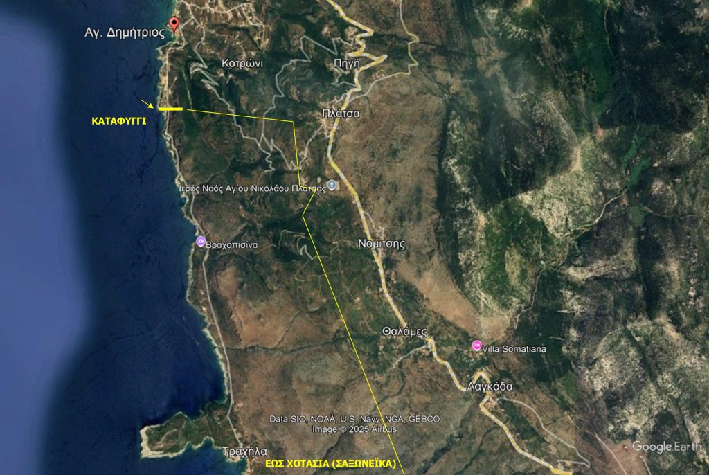
A particularly important decision for Messinia and Messinian Mani was signed by the Minister of Culture, Lina Mendoni, declaring and demarcating as an archaeological an extensive area that includes the locations of Trimesi, Vathi Lagadi Trachilas, Trachila, Paganes, Paganitsa and Selinitsa, in the municipal unit of Lefktro, of the Municipality of West Mani.
It is for the entire coastal area enclosed by the “Katafygi” area after Agios Dimitrios, up to and after Trachila up to the boundaries with its settlement Hotasias and goes up to below Nomitsi, Lagada and Saint Nikon.
The decision of the Minister, has already been published in the Government Gazette, together with the topographic diagrams.
Caves and rock roofs
It is a huge area and the decision aims at the effective protection of caves, rock shelters and ancient sites that preserve valuable remains from the Paleolithic Age to modern times, forming a rare mosaic of natural, geological and cultural heritage.
Mani, with its special landscape, has been a place of habitation and refuge since ancient times. Its caves and rock roofs were used by prehistoric man for living, but also as places of ritual or storage. In many of them, stone tools, pottery, traces of fire and animal bones have been found, which testify to human presence as early as the Paleolithic and Mesolithic periods.
Later During the Classical and Roman periods, several of these sites They were reused – either as places of worship or as shelters. In Byzantine times and until modern times, the same caves continued to be They are places of refuge in times of raids or persecution, but also hiding places families in the area.
The caves and rock shelters also served as pens, as pirate watchtowers and as shelters in cases of enemy raids.
The coexistence of the historical remains with the unique geomorphology of Mani composes a landscape of special physiognomy, unique in Greece.
What does the Declaration of the archaeological site
With this decision, a polygonal space is delimited that encompasses the above areas, with coordinates recorded in the relevant topographic diagram. It is an institutional “shield” of protection, which ensures that From now on, no activity will be able to threaten the monuments without the approval of the competent archaeological services.
The decision of the Minister, which was published in the Government Gazette 662/D and has the unanimous opinion of the Central Archaeological Council, does not include special conditions of protection or building.
This practically means that the terms will be clarified by the Special Urban Plan that is being prepared and concerns the Municipality of Kalamata and the Municipality of West Mani.
Anyway and before the declaration of the specific area as archaeological, due to the scattered monuments that exist throughout Mani, each publication of an urban planning is accompanied by the approval of the competent archaeological service.
In decision of Ms. Mendoni, it is emphasized that the aim is to is “the most effective
protection caves and rock shelters, most of which preserve ancient remains from the Paleolithic Age to modern times, as well as important ancient sites and monuments, which make up a set of special of geological, historical and archaeological value, being part of a landscape of particular and unique in Greece”.
By Vicky Vetoulaki – Tharros